Mapping Out One’s Ideas
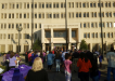
The Geospatial Intelligence Poster Making Contest took place November 16 at the Rudolph Jones Student Center. Occurring as the grand finale of Fayetteville State University’s Geography Awareness Week, the event saw participants creating maps and charts in order to show how versatile geospatial intelligence can be in displaying and explaining various topics of interest. Including subjects ranging from crime to history, the results presented at the contest were awesome and very diverse.
Five judges were present to analyze the posters, provide constructive feedback and ultimately choose three winners to win cash prizes. Dr. Trung Tran, event organizer and assistant professor in Geography in the Department of Government and History at FSU said the posters were judged on three criteria: visualization, research set up, and poster presentation. The visualization of the poster referred to how the poster looked, and its attractiveness and ability to draw in viewers. Also, the research should be set up in such a way that the information on the poster is clear and show that the proper methodology the researcher used in order to utilize the data correctly. Lastly, how well the students presented their poster was essential to the judging because the main idea of the poster had to be conveyed to individuals even if they were not familiar with the research topic.
To keep things even more interesting, anyone attending the poster competition could vote on which poster they were drawn to the most, and the winner was to receive a prize of an Amazon Echo Dot.
Saying that the contest displayed a variety of topics is an understatement. Looking at the different posters, it can be clear that geospatial intelligence can be applied to virtually anything.
For example, a pair of students, senior Kyle Brown and junior Alyssa Price decided to focus their project on sex trafficking in the United States (narrowing their focus on North Carolina). According to Price, the reason they chose this topic was because they wanted to “bring awareness to the community about the recruitment tactics that sex traffickers use and what to look for when they are out and about in town.” Brown then added that another reason they looked into their topics was because after finding out that a child was taken here in town, they decided to look into similar incidents in the U.S. and compare them to those in North Carolina.
Another entry had more emphasis on cartography (making maps). The focus of Leah Holt’s project was to show how making maps can be used for fun. Making a map of Ireland (Holt’s native country), she listed locations for skydiving as well as weather patterns that show the best locations and times to jump.
Andrew Thetford brought a bit of Asian history into the contest by campaigning the height of the Sengoku era of Japan, focusing on Oda Nobunaga and how he unified Japan. Explaining why he chose this topic, Thetford stated that he was “deeply interested in the Sengoku era. I saw this as an opportunity to research and deeply dive into the subject and really get into the matter and timeline.”
The winners were announced by Dr. Tran. Third place went to Tyrek Clark, second went to Jaden Ormand, and first place went to Corey Bissen. For his project, Bissen did a spatial analysis on Fayetteville and its crime rates. He displayed where and how often crimes happened in the city.
The contest was part of Geography Awareness Week. Sponsored by a leader in the technological development of geographic information systems or GIS software, Caliper Corporation, and a company founded by FSU alumni Kendrick O. Faison, SpatialGIS, this was FSU’s second successful showcase of the event. Held the third week in November, GEO week provides students with an opportunity to expand their knowledge of geography, GEOINT and their practical applications in the real world. It also presents an atmosphere in which students can network with professionals who utilize GIS in their work and faculty from the geography department.
Judges and participants alike felt that the event did really well to promote geospatial intelligence to FSU. The skills students who campaigned their projects during the contest were definitely worthy of praise.
Dr. Tran stated that the students have “been working very hard. The students had to identify research topics and questions, then collect, analyze, and manipulate data, as well as create a visualized product of their research which is their posters.”


Leave a Reply
You must be logged in to post a comment.